
TideClaw
Real-time water quality monitoring for every coastline
Solar-powered sensor buoys giving coastal towns continuous water quality data — year-round, not just summer.
A Seaside Labs project, designed in Wareham, MA. Pilot site at Swifts Beach. Built with municipal harbormasters, conservation groups, and shellfish associations in mind.
Continuous water data for coastlines that mostly don't have any
Most coastal communities rely on summer volunteer sampling — weekly spot-checks for bacteria during beach season. From October through April, most locations have no water quality data at all.
TideClaw changes that. A solar-powered sensor buoy takes 15-minute readings of dissolved oxygen, pH, temperature, and turbidity year-round, streaming to a public dashboard. It catches the overnight oxygen crashes, the nutrient spikes, and the early algae bloom signals that weekly sampling misses.
What TideClaw monitors
- Dissolved oxygen — the #1 indicator of ecosystem health. Crashes signal blooms, nutrient overload, and fish kills
- pH levels — shifts reveal active photosynthesis from algae blooms and acidification trends
- Temperature — warm water drives bloom growth. Critical for predictive early warning
- Turbidity — water clarity drops when blooms are dense. Secchi depth replacement
- 15-minute intervals — continuous data, not weekly snapshots
- Algae bloom detection — our sensor suite provides early warning indicators for harmful algae blooms through DO, pH, and turbidity pattern analysis
One buoy. Year-round data. Hundreds of miles of coast.
Shellfish beds, swimming beaches, marinas, and marshes — most without continuous monitoring.
Most volunteer sampling programs stop in October and resume in May. Nutrient loading and low-oxygen events don't.
Continuous readings catch the overnight and between-sampling events that weekly spot-checks miss.
Dissolved oxygen, pH, temperature, and turbidity — streamed to a public dashboard.
Early warning for harmful algae blooms
Harmful algae blooms are a growing threat to Buzzards Bay and coastal communities across New England. Warming waters, nutrient runoff, and aging septic systems are making blooms more frequent and more toxic. Towns need earlier detection — not advisories posted days after a bloom is visible.
Spikes during photosynthesis, crashes overnight
A bloom's daily oxygen cycle is unmistakable in continuous data — and invisible to weekly spot samples.
Active bloom metabolism shifts the water's chemistry
Sustained pH climb is one of the earliest chemical signals a bloom is building — often days before it's visible.
Water clarity drops as blooms grow dense
Turbidity trends over a few days tell you whether a bloom is forming, holding, or clearing.
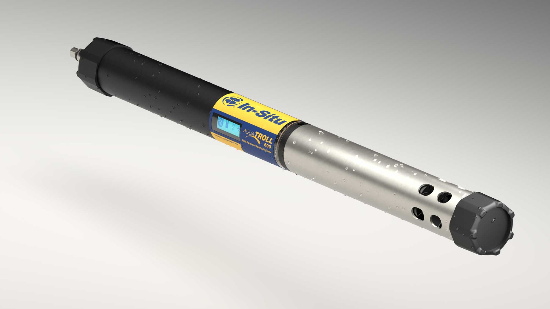
For permanent stations, the In-Situ Aqua TROLL 600 adds chlorophyll-a and phycocyanin ports — direct measurement of algae biomass and toxic cyanobacteria.
Prototype to prove it. Professional stations to make it permanent.
Step 1. A prototype buoy — low-cost open hardware, four sensors, solar-powered — built to get in the water within weeks. It collects 90 days of continuous readings to validate accuracy and support grant applications.
Step 2. A professional-grade monitoring station (In-Situ Aqua TROLL 600 or equivalent) with EPA-comparable accuracy, 6–9 month maintenance cycles, and optional chlorophyll-a sensors for direct algae detection. Grant funding covers multiple permanent sites from a single award.
Swifts Beach, Wareham MA
Swifts Beach on Buzzards Bay is where we want to put the first buoy — a community directly affected by water quality changes and harmful algae blooms. Once we have a partner and the funding in place, 90 days of continuous readings would give us the proof to build the case for permanent stations.
The plan
One prototype buoy at Swifts Beach, validated against existing monitoring data. If the validation holds up, that opens the door to additional buoys and scientific review with local environmental organizations.
Three ways to help launch TideClaw.
The first buoy needs a site, a partner, and the dollars to get in the water. Any of these help.
Host a deployment
A municipality, watershed group, shellfish commission, or nonprofit that can anchor a single-beach or single-harbor deployment.
Co-apply with us
An eligible 501(c)(3), tribe, estuary program, or academic partner who wants to lead a monitoring grant application.
Fund the first buoy
An investor, family office, marina group, waterfront business, or environmental backer who wants to fund the first deployment.
Roughly $400 buys the prototype hardware. 90 days of continuous data opens the door to multi-site grants from a position of proof.
Send us a note
Tell us who you are and what you're working on. We'll get back to you directly.
Thanks — we got it.
We'll be in touch soon.